

Guest Blogger – Dr Emma Rehn (@BlueRehn), James Cook University and ARC Centre of Excellence for Australian Biodiversity and Heritage (CABAH)
Alongside the fascinating artefacts and objects in the archaeological collections at Queensland Museum, you’ll also find a range of maps and drawings. Archaeological illustrations record crucial data and come in many forms – read on to learn more about visuals in archaeology in honour of National Archaeology Week.
Recording archaeology
Archaeology requires extensive record-keeping. This is because archaeological processes like excavation are destructive and therefore, we need to document as much information as possible so that nothing is lost.
Hand-drawn illustrations have long been a part of archaeology, predating the invention of photography. While taking photographs is now as common as writing notes, drawings (on paper or digital) are still used to record artefacts, stratigraphy (the relationship between soil layers, artefacts, and any other features in an excavation), and archaeological sites.

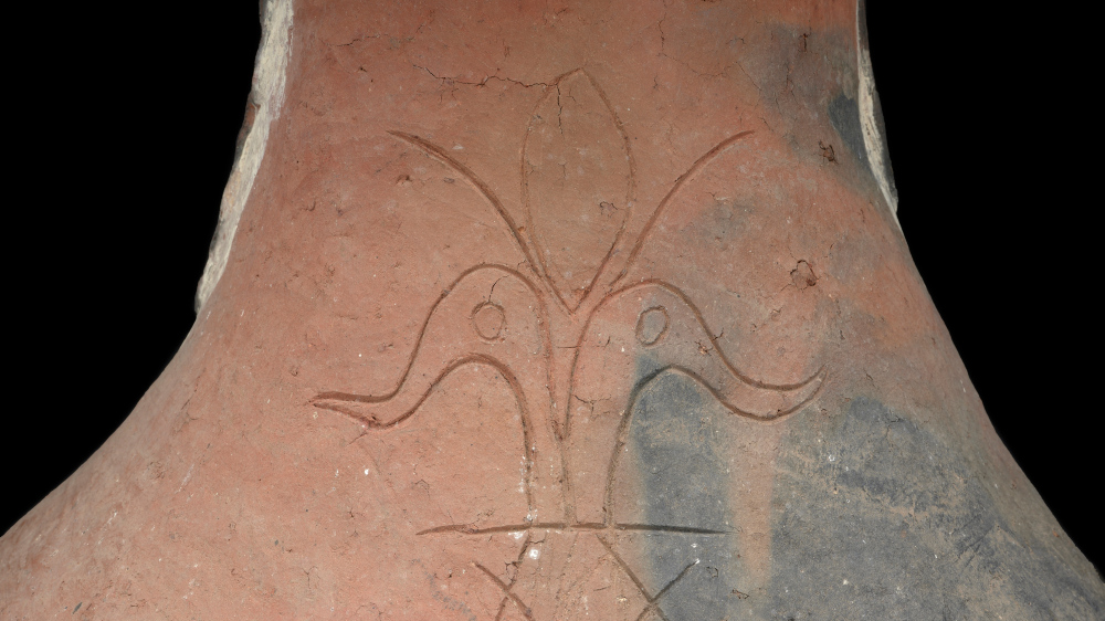
Unlike photographs, illustrators can choose which details to include and which to leave out of their images. For example, illustrations of stone artefacts precisely record curves in the surface where flakes of stone have been chipped away (flaked) as this shows how the artefact was made. Consistent rules in how artefacts are drawn mean that a lot of information can be captured simply, such as the different meanings behind a dashed or a solid line.
Mapping things
Mapping is an important type of recording, as archaeology is centred around where things are found in relation to each other. Maps can capture how features (for example a scatter of artefacts, a hearth, the remains of a stone wall etc.) are arranged in a site, or even how sites are placed across a landscape. Maps can take many forms and may be drawn by hand, recorded digitally, or put together in a combination of both. Just as illustrators drawing an artefact must choose which details to include, mapmakers must also make choices about which details are important. Some examples are “mud maps” that are focused on key features and the overall layout of a site rather than exact measurements, and topographic maps that show features of the land surface like elevation.

The drawing on the left is the original graphite drawing showing the layers of sediments (including a flood layer and sandy loam) overlying a drain feature lined with bricks and volcanic rock (Brisbane tuff). The drawing on the right is the inked version of the original drawing, prepared for publishing.
Going high-tech
Recent advances in technology have added to the tools available to archaeologists to capture visual data. Drones, satellite imagery, and LiDAR (3D laser scanning) let us create high-resolution maps and can help to find previously unknown archaeological sites.
Photogrammetry (using photography in surveying and mapping to record measurements between objects) and 3D modelling (using computers to generate 3D digital representations) can be used to create digital models of artefacts and even excavations, like the life-size reproduction of a midden excavation featured in the Connections Across the Coral Sea exhibition at the Museum of Tropical Queensland.

3D models and virtual reality can also be used to digitally reconstruct sites and let people experience them without disturbing the original site. Technological developments continue to expand the options available to archaeologists to record and share visual representations of their work, complementing traditional forms of drawing and illustration.
From exploring new sites and excavating material, to examining and interpreting finds, to sharing knowledge with the public, visuals are a powerful tool for archaeologists.
Follow us on social media to find out more about what we’re doing in National Archaeology Week.

You must be logged in to post a comment.